Monday, September 16, 2013

Trip Summary


Days: 11
Total Miles Between Stops: 3683
Total Miles: 3948

Hero: As usual, Betsy didn't miss a beat.  All she requires is gas, oil, and tires and she's ready to roll.  I love my rice-burner.

Day 10 - Kick The Poo Outta You

Day 10 - Santa Fe, NM to San Angelo, TX - 504 Miles
September 15, 2013

As usual, up early, but not on the road.  Headed to theTecoloté Cafe for breakfast.  This is yet another of the Diner, Drive-ins, and Dives restaurant. As reported, the buffalo hamburger at the Tune-Up Cafe last night was great, and I was looking forward to breakfast this morning.  But I eschewed the Chili Rellenos and Eggs, was significantly drawn toward the homemade Corn Beef Hash and eggs, but persevered for my Chilli and Eggs.  Had to make my own by ordering a couple of eggs and a small side order of their red.  Should have asked for the shredded cheese and some chopped onions, that would have made it a real Chilli and Eggs breakfast, but, the chilli was good and it worked. So...filled up with gas in every sense...I headed out for Texas.

I am a big fan of New Mexico.  I think it is one of the best kept secrets in the U.S.  Great and variable country side, friendly people, and more miles and miles of miles and miles.  What's not to like?

Looking west toward the Sandia Mountains.  On the other side is Albuquerque.  On this side is an excellent golf course I once played with a 295 yard par-3; fortunately with a big "down," so you could reach if you could hit a 200 yd shot.


This isn't the sand trap.
A little further and it's ranch land.
And all the beauty isn't vista.  Nature, as usual, does a very good job out here.
 
Some neat cactus

By the time I reached Vaughn, NM, I was becoming concerned about the availability of gas on the long reach down to Roswell.  My friendly and ever efficient GPS was telling me there was no fuel in my future for something like eighty or ninety miles (Roswell).  The closest behind me was in Cline's Corner back up by I-40 some forty-plus miles back...and we know, we can't go back.  Don't we?  But I believe in the capitalist system.  Given those distances, I'm sure there's gas in this town though my Garmin friends didn't get paid to tell me about it.

As I pulled into town I thought at first there had been a wreck involving a very neat old classic car because it was parked cattywampus to the curb with a police vehicle behind it with lights on.  But, upon closer examination I note some motorcycles and more classic cars lined up down the street ninety degrees from my route.  Ha, said I, a parade.

A few minutes later, unsuccessfully exiting before the parade caught up to me, I watched as it pulled through town.  Took at least ten minutes.
 

 A little research subsequently yielded that the population of the town is estimated at ~438 in July 2011.  The police vehicle I saw was probably driven by a non-sworn officer who, with a police dog was all that remained of the police force after the resignation of the police chief in Sept. 2012 when criminal charges were brought against him.  The county sheriff patrols the town at this time and, according to Wikipedia, Homeland Security states it is a known drug smuggling route.  You just never know what information a parade can create, do you?

Things were uneventful...even in Roswell...for the remainder of the trip today.  Desiring to end this trip with a stop attuned to the initial subject matter, i.e, conflicts between original and moving-in-and-taking-over man, I chose to visit one of my favorite Texas towns and areas: San Angelo.

San Angelo was home to one of the most famous of the frontier forts, Fort Concho, founded in 1867, located near the confluence of the North, Middle, and South Concho rivers.  The most famous commanders of this famous fort were the previously mentioned Col. Ranald Mackenzie who performed his many military feats against the Indians from this base, and Col. Benjamin Grierson, famous for his 1863 expedition through enemy country severing communications between Vicksburg, MS and eastern commanders of the Confederacy during the civil war, and his post-war organization and command of the 10th Calvary Regiment known as Buffalo soldiers between 1866-88.

But Fort Concho and its importance during the Indian wars aren't the only related story in the San Angelo area.  On January 8, 1865, a force made up of 160 Confederate troops and 325 State Militiamen attacked a large encampment of peaceful Indians migrating south to Mexico to take themselves out of the way of the violence of the Civil War.  Much like the later Custer, the two commanders ignored advice from scouts and other sources that these were not a combative tribe, and failed to coordinate their efforts because of all-to-usual petty military jealousies, resulting in their getting their military asses kicked by the Kickapoo tribe of about 2,000 souls on a very cold day near Dove Creek twenty miles southwest of San Angelo.  A very good piece about this event in Texas history written by famous western writer Elmer Kelton can be found at: Battle of Dove Creek - 1865.  (Kelton also deals with this subject in his story of the changing views of legendary Texas cattlemen, 'Stand Proud.')  

I think Texas is, as I surmised about Colorado and the Sand Creek Massacre, not very proud of it's role in this particular battle.  Not to mention, they lost.  There is no Dove Creek Battlefield site.  In fact, I do not know if anyone knows exactly where the site is, it's mostly private land in the area.  The only official recognition this event occurred is a Texas Historical Marker (#523500115) near Mertzon, TX which states, "On January 8, 1865 eight miles east of here Confederate troops and Texas militiamen engaged a large party of Kickapoo Indians..."  Eight miles east of here??  That certainly brings it home for one, doesn't it?  As noted, it is mostly private land, but I was able to get here and I'll guarantee you the site of the actual battle is less than eight miles from this point since this point is about eleven miles east of that marker.

Pulled into town, got a room, and a great meal at Johnny Corino's before reading myself to sleep. 

Saturday, September 14, 2013

Day 9 - Working My Way Back to You Babe

Steamboat Spring, CO to Santa Fe, NM - 398 miles
September 14, 2013

Slept in a little this morning.  Woke up early, but refused to get out of bed at that time so managed an extra hour or so of sleep.  On the road by 8:30am, though, once again geared up for the rain.  That works, didn't get any until a couple of little sprinkles late this afternoon in New Mexico.

The bad news is I guess I didn't get the smudge off my small camera lens because most of the pictures I took stunk.  The below have the defect but it's somewhat mitigated by the scene.  The topography is really changing.  I'm going from the lush green of a very wet Colorado, to the brown and tan of a wet New Mexico.


Arrived in Santa Fe, one of my favorite cities in the world, about 5:30pm, got a room and, after my road shower, immediately pulled out for dinner at the Tune Up Cafe, one of the Diners, Drive-Ins, and Dives locations programmed into my GPS.  I'd grabbed a bowl of chilli and piece of pie rather late in the afternoon so wasn't very hungry.  I got a Buffalo Hamburger with hand-cut fries.  All were excellent, but, after all, it's not Tavern On The Green, it's a diner, for crying out loud.  But the food was of great quality.

Tomorrow morning, breakfast at the Tecolote Cafe, another of D,D, & D's places here.  They specialize in breakfasts.  I find it difficult to believe they don't have chilli and eggs, my favorite bar none.  I'll suggest it while I'm there.  I'm leaning toward Chili Rellenos and Eggs.  I'll let you know...but I'm pretty sure this will be good.

Friday, September 13, 2013

Day 8 - More of the Same

Lander, WY to Steamboat Springs, CO - 287 Miles
September 13, 2013


On the road by 7:30am looking at rain all day long.  The weather didn't disappoint.  Other than getting "Garmined" again, nothing much happened.

What's "Garmined?"  Well, it's like this.  Traveling US287 toward Rawlins, WY my route was mapped as follows:
I was instructed to turn right on US287.  But, first, I needed gas so I pulled into the gas station I've denoted on the picture.  I didn't pay attention to the Garmin Lady (I use that term loosely) screaming "Recalculating!", "Recalculating."  I remember thinking, why?, figure it out.
Anyway, as I pulled out of the station I started to turn left and the Garmin Bitch began yelling "Turn right on WY220, turn right on WY220."  I stopped and sort of scratched my head and then did the totally stupid thing, I listened to the bitch.  I turned right thinking, we'll she must know what she was talking about.  I now realize that she didn't have a f*&^ing clue.  I tooled down the road passing several places where I could have been instructed, or, better yet, decided this was crazy and turned around myself, but I heard nothing from the now-oh-so-rarely silent "voice from hell."  Imagine my surprise when EIGHTEEN miles, that's EIGHTEEN f*&^ing miles down the road the voice comes back to life and say turn right on WY220 in 1.2 miles then displays a screen showing me a rest area with the dreaded U-Turn symbol.

The only thing that makes sense is the damn machine decided when I went straight about 300 yds to get gas I no longer wished that route and wanted a new one.  But, then, why didn't it give me one? Why did it go EIGHTEEN f*&^ing miles down the road to decide "hey, this shit ain't working?"  I'm sure I'll never know because the only thing worse than their unintuitive software is their customer service.  They couldn't spell customer service if you spotted them six letters of each word.  Memo to Garmin: Up Yours!


 My usual scenery for the day.  Except, usually it was over me but just sprinkling.  I'm not complaining.  Much of the state east of me is getting hammered.


Believe it or not, this represented a clearing up.  The scene above was to my left (east) while this was to the south.  It actually stopped raining until I arrived in Steamboat Springs.


I'm concerned about the shape of the roads south of here so thought I'd spend the night here and check 'em out.  There have been reports of many mud and/or boulder slides and road blockages because of the "Biblical" rains they've been having.  I'm not buying into that appellation; haven't seen any animals pairing up at all.

Sorry there's no good pictures.


Thursday, September 12, 2013

Day 7 - Cold and Wet

Cody, WY to Lander, WY - 277 miles (the long way)
September 12, 2013


Early to bed, early to rise...yeah, but 1:36am is pushing it somewhat.   Don't know why, woke up and had a heck of a time getting back to sleep.  I guess I wanted to ride, but not in the cold, and certainly not in the dark out here in the middle of no-damn-where America.  Way to many forest rats running around here.

On the road by 7:30am heading into the East Entrance of Yellowstone.  Nice easy ride.  About 17 miles from the park entrance my Garmin starts squawking "rain in the area."   As if I didn't know, I'd been watching the clouds for twenty minutes.  But, in keeping with the new "boy scout" (always prepared) me, I eschewed waiting until the rain was falling to don the rain gear (the old me) and pulled over and put it on.  I'd already armored up including the cold-weather insert to my riding jacket because I knew it was going to be chilly leaving and would not improve as I moved from 5,000 ft. to 9,000 ft.  I was absolutely prescient.  And the drizzly rain added to the cold as well.  Can't say enough about how important it is to stay dry. Fortunately, I have good rain gear.  Never got a drop on me except whenever I lifted my helmet visor from time to time thinking the sprinkling had ended and, of course, my hands.  Gloves are another story.

When I packed up I threw, I thought, four pairs of gloves, one pair cold weather, into my bike trunk.  When I first went looking for the cold weather gloves the other day while climbing up the Beartooth, you can imagine my surprise to find only one of them.  I scrambled around looking here and there, pulled all gloves out and, yep, I was missing one and it was a cold weather glove.  Murphy's alive and well, huh?  You don't know how alive and well.

Loading up this morning I again looked for the missing cold weather glove to no avail.  Consequently, my ride up to the 9,000 ft. level in the cold rain got just that, cold.  Cold and wet hands are a problem since they get the force of the wind.  But, by trading out for dry ones as I went along, it wasn't too bad.  I've experienced a lot worse.  After coming down from the great heights and about 60 miles from parking here in Lander for the night, imagine my surprise when that missing cold weather gloved peaked out from below some tools in my tool back.  I'd gassed up and was looking to put on my third and last dry pair when I noticed this thumb sticking out from under some tools and the mate to it lying off to the side.  Having the lightning intellect for which I'm so famous, I immediately deduced a) I'd found the other glove, and b) I was an idiot.  But, now, an idiot with warm hands.

Not much in the way of pictures today.  It was just a rainy day, and everyone's seen those.
 
This was coming out from Grand Teton into the Shoshone National Forest.  Everything is wet, including the smudge on my lens.

The Wind River


Pulled into Lander and decided to put it away for the night.

Wednesday, September 11, 2013

Day 6 - Back to Beauty

Red Lodge, MT to Cody, WY -  113 Miles
September 11, 2013
Forced myself to stay in bed until 9:00am this morning.  No reason to be out there.  The forecast for Red Lodge this morning was 45° F.  I can stand that, but don't have to.  Plus, where I'm going it would be closer to 22° F.  So I stayed in bed and had a leisurely breakfast, pulling out for the Beartooth on Hwy 212 about 10:15am.


Scene leaving town.  This area has not been immune to forest fires either.

But it gets better

And better
Mr. Garmin's prediction of the future
Stopped for a couple of pics
 Unbelievable beauty
 Kilroy Was Here

From this point it's only 2,000 more feet up before you start the big down.  I missed the scenic stop to see Beartooth mountain, so if any wish to see what it's like you can see it here: Beartooth Ride 2007

About 14 miles from my planned turn onto Chief Joseph Highway (Hwy 296) I was greeted with the below:

They were repaving the highway and had one-way traffic.  The sign raised my heartbeat a little: "Gravel, drive carefully."  Well,...yeah...and duh.  The hardest thing about this ride was the wait.  We sat there for over 45 minutes before getting the "leader" truck to take us through.  Turned out to be a very short span of gravel, beaten into smooth ruts, so no trouble.  

The road follows the path of Chief Joseph and his Nez Perce tribe through this area in their  1,170 mile fighting retreat from U.S. forces.  I knew they had traversed Yellowstone, but did not know until seeing a PBS special on National Parks that some hot heads from the tribe actually attacked and killed some vacationers in the park in 1877.  (Yellowstone N.P. came into existence in 1872)
Dead Indian Hill
The Nez Perce had almost pulled off their plan to evade U.S. forces and join Sitting Bull in Canada.  This was their last major natural obstruction before entering the high plains with a straight shot north to Canada.  They rushed to get over this blockage hoping the troops would have a difficult time of it.  There was one tribe member too wounded to make it up the steep slopes so they were forced to leave him, wounded, at the bottom of the hill.  When the troops came through they kill him on sight.  Hence the name.

A short time later I turned right on Hwy 120 and pulled into Cody, WY about 2:30pm.  

I have never entered Yellowstone from the East Entry (from Cody).   I decided to stay here in Cody tonight in order to give myself plenty of time  for this entry into the park.  Had I have gone in this afternoon I would have been rushed to get out of there and through Grand Teton with much light left.

Tuesday, September 10, 2013

Day 5 - 0 for 4 Sign Him Up

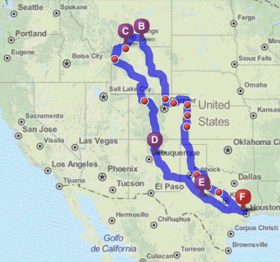
Sheridan, WY to Red Lodge MT  284 (Round about, Garmin, *&^%&^ miles
September 10, 2013

(Click to Enlarge)

Up early but in no hurry this morning, I have a short ride today. 

Not sure what's going on with my GPS but it believes the fastest way to get to the Rosebud Battlefield State Park (B) above, is the route shown.  It's almost a 100 mile round trip from where Hwy212 joins I-90.  According to mapquest (after the fact...yeah, I know, stupid) there is a 37 mile route from Sheridan through Decker, WY on Hwy338.  I been Garmined...again.  But that's not all the bad news about getting to Rosebud Battlefield.  When I reached the road to go to the park I was looking at 2 1/2 miles of pea-gravel.  Nothing wrong with pea-gravel, unless you want to stop.  Then it's the equivalent of stopping on ball bearings.  Betsy don't do pea-gravel except in very short stretches.  Nothing short about 2 1/2 miles so, you guessed it, I turned around and headed back to Little Bighorn Battlefield National Monument.


The site is a U.S. Military cemetery with veterans (and spouses) from many wars, predominately WWII.  But a lot of the graves are those of troops killed during the various Indian Wars including the troops from the Fort Fetterman Massacre.


But, of course, the big deal here is Custer's Last Stand.  On 25 June 1876 Custer led his 7th Calvary consisting of approximately 600 troopers and scouts into the Valley of the Little Big Horn. His scouts reported locating an Indian camp early on that morning.  Custer, significantly underestimating the size of the encampment and the number of warriors potentially present made one of the cardinal errors of the military art.  He split his forces, retaining 5 companies and sending 3 companies each with Maj. Marcus Reno and Capt. Frederick Benteen.  Benteen was to scout the bluffs to the south while Custer and Reno headed toward the village.

Near the river Reno was ordered to cross and attack while Custer and his troops continued northward to halt any retreat of the villagers in that direction.  Reno was attacked by significant numbers of warriors.  Realizing he was vastly outnumbered he dismounted and formed a line of battle.  Unable to hold and quickly outflanked, Reno was forced to retreat "in disorder" (read: run like hell), and take up defensive positions on the bluffs above the river.  He was joined by Benteen who had hurried forward under orders from Custer to "Come on; Big village, be quick, bring packs."

Whenever the fighting lessened in his front Reno sent an advance company under Capt. Thomas Weir in an attempt to determine Custer's location.  Advancing about a mile Weir crested a high hill from which he could see the area now known as Last Stand Hill.  At this point there was no firing from that quarter.  In fact, the Indians, regrouping, turned and attacked up the hill on which Weir was holding.  After coming under attack there, Reno pulled the troops back, and his and Benteen's  companies joined with the company assigned to guard the wagon train and returned to his original retreat position on the bluffs overlooking the Little Big Horn.  There they successfully withstood attacks and discouraged further forays by the Indians through this and the next day.  The seige lifted when the Indians learned of Gibbon's approach from the north.


The next two pictures probably give the best idea of that the terrain was like where this battle was fought.


High grass with little cover.  No place to run, and little in which to hide.


This is the view from the bluffs above the Little Big Horn from which Reno was able to hold  until the siege was lifted.   He first entered the valley from about a mile to the left.

Looking further to the right is the area across the river where the Indian "village" was located.  It was one of many.  Spread out further along the river were the  "villages" of Uncpapa, Blackfeet, Brule, Oglala, Minniconjou, Sans Arc, and Northern Cheyenne.


About a mile further to the right Custer led his 5 companies down an escarpment called Medicine Tail Coulee pointing directly at a ford across the Little Big Horn.  At this point he would have been able to see "all" the villages present. There are disputes about what he did at this point, but it is obvious what he didn't do: He didn't make the connection between the numbers of teepees and the possible force of braves he might face.  A prudent commander would have and, I think, turned back to unify his force in the face of such opposition.

Given his predilection for the attack and his stated goal of circling and stopping a retreat from the villages to the north, there is good evidence he split his force YET AGAIN(!) sending Companies E and F to try to cross the ford, leaving himself with Companies C, I, and L on the ridge as support and, equally important, as a rallying point for Benteen who he had ordered to "come quick."

By this time, the forces coming at him from the villages were many and close, I believe, forcing his two companies at the ford back up the hills and instituting a running fight to the end.  His remaining forces temporarily re-united at Calhoun Hill where another skirmish line was established by Company L under Lt. James Calhoun.  This probably gave some small relief to Custer and his troops in their flight toward the highest ground they could find, but it didn't last long.  The position was overrun with the further disaster of the company's horses being scattered trapping them there to their destiny.  But the end is near now.  Custer and his command  reach Last Stand Hill.  Capt. Myles Keogh's Company I and remnants of C Company were cut down by Crazy Horse and White Bull on Battle Ridge while attempting to join with him there.


The site at Calhoun's Hill where Company L formed a skirmish line.  Their horses were held in a small ravine just over the hill to the left.
There is a large grouping of headstones near the bottom of the hill.


A closer view.


The picture above makes the point about a running battle taking place here.  To the far right is the grouping of Company L headstones.  You can see the line of markers coming up the hill toward this position on the side of Last Stand Hill.  It had to be unbelievably horrific for those troops.


Custer and about 41 of his men are isolated and under fire from many positions.  Killing their horses for use as breastworks they make a stand.  Custer, his brother, Tom, and Lt. William Cooke are found near the site of the 7th Calvary Monument now erected at this site. 

This monument is just behind the grave sites shown above indicating where Custer fell.

There can be little doubt that Custer overestimated the capabilities of his command, and underestimated those of his opponents.  Additionally, he made the often fatal mistake of ignoring intelligence reports regarding the strength of the forces arrayed against him and then split his forces at least twice during the battle.  Those brave troops deserved much better leadership than that.